

LIS – Land Information System
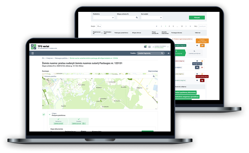
A modern national information system transforming the administration of state-owned land in Lithuania. It brings together digital land administration services, spatial data, maps and information from government registers in one place. Residents, businesses and public-sector organisations can request land lease, sale, use, easement, construction consent and other services, track their progress and complete the required steps remotely. Integrations with the TPS “Vartai” portal, government registers and LIS EDVP automate data submission and validation, reduce administrative workload and accelerate decision-making. The result is a unified, transparent and data-driven approach to state land management based on the one-stop-shop principle.
The challenge
The task
The objective was to create a comprehensive information system bringing together multiple land administration processes and making them fully digital.
The system had to support seamless collaboration between public-sector organisations, integrate with numerous government information systems and registers, and enable convenient, fast delivery of digital services to residents.
A further priority was ensuring data traceability and security, electronic signing, and automated communication between system users.
Main features

Digital land services
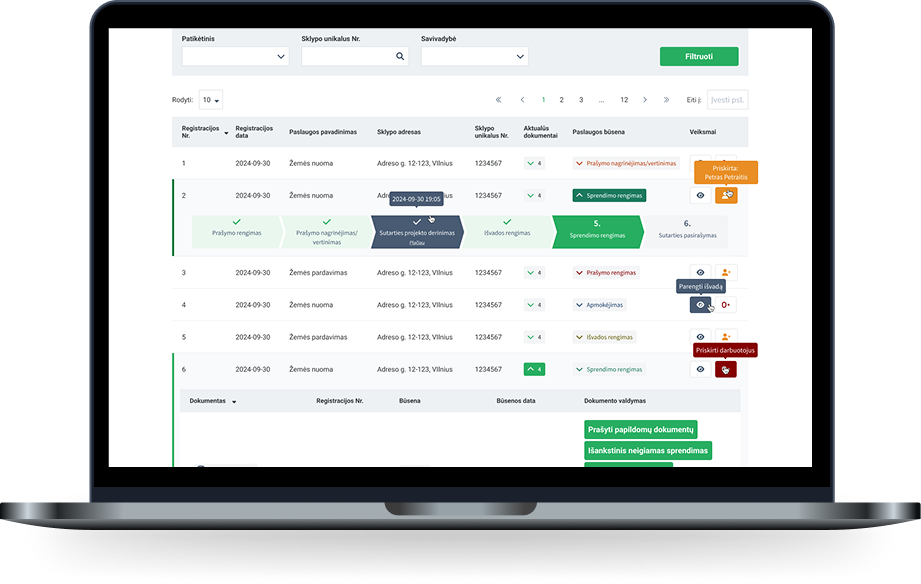
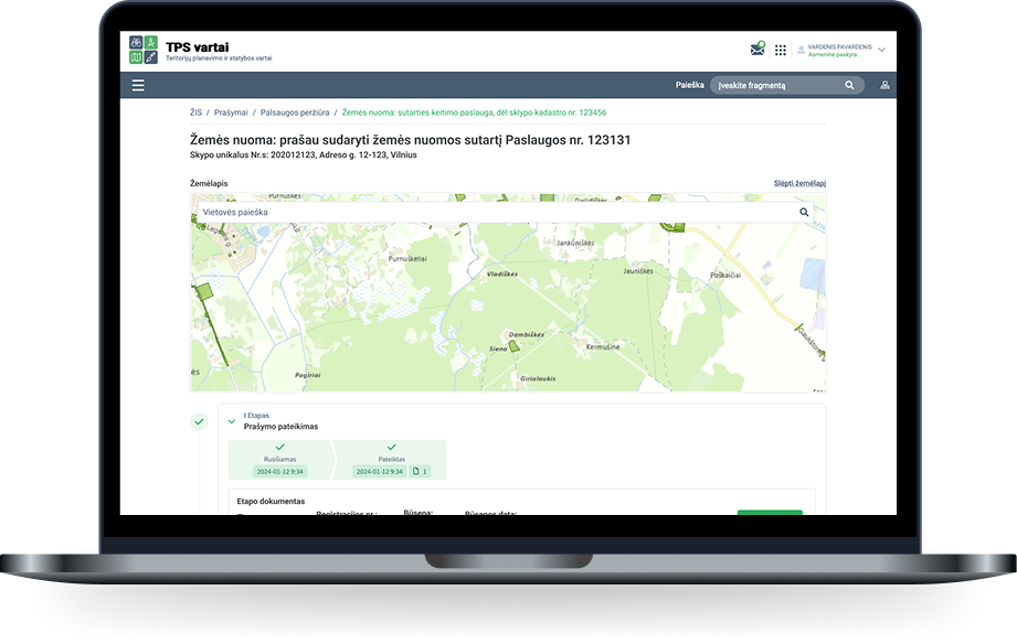
Requesting public land services, submitting applications, processing them and tracking service progress.

Maps and spatial data
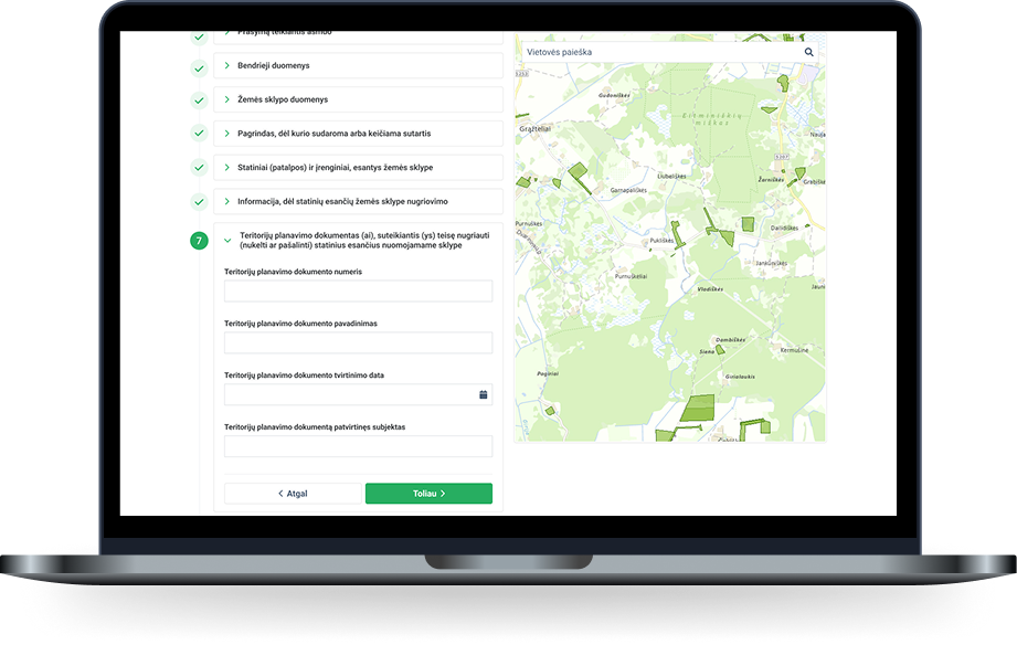
Viewing and selecting land parcels, territories and related data on an interactive LIS map.

Automated processes
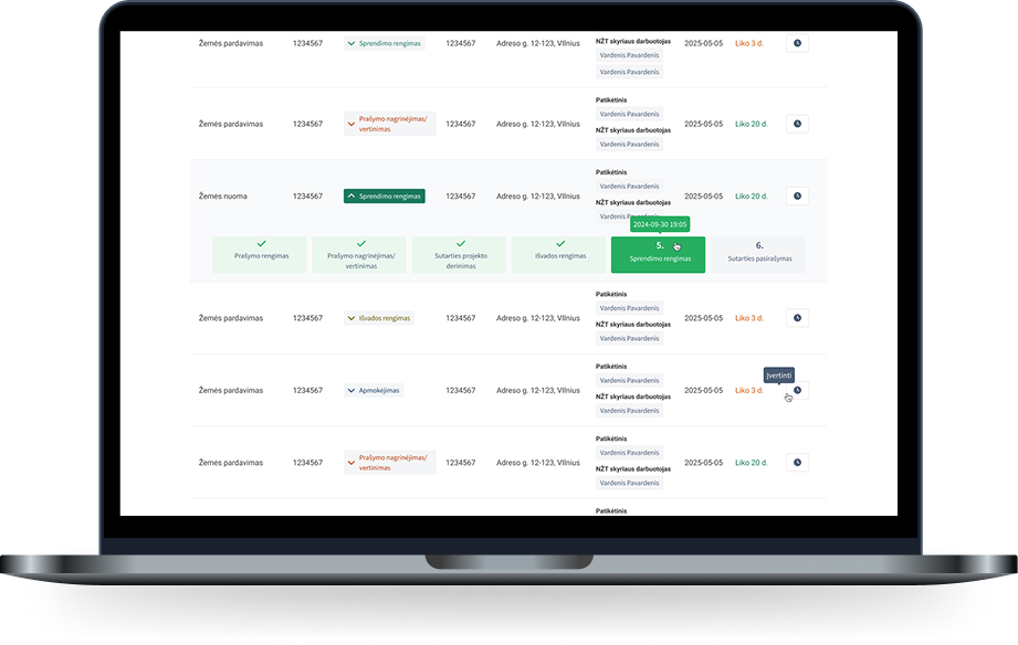
Managing applications, documents, deadlines, notifications and decisions through automated service workflows.

Register data integration
Automatically retrieving and validating data from the Real Property Register, Population Register, Register of Legal Entities and other government registers.

Document management and signing
Generating documents from templates, reviewing and editing them, applying electronic signatures, registering and archiving them.

User and access management
Administering internal and external users, roles, permissions and access to system functions.

Notifications and reminders
Sending automated notifications, service-status alerts and deadline reminders.

Task management
Creating and assigning tasks to responsible employees and monitoring their completion.

Integration management
Exchanging data with the TPS “Vartai” portal, registers, document management systems, VIISP, LIS EDVP and other government information systems.

Reporting and analytics
Searching and analysing service data and generating reports based on selected criteria.

Audit and control
Recording system actions and events to ensure traceability and operational control.

Archive
Storing completed services, documents and other archived data while keeping it accessible.

The result
LIS – Land Information System
Together with the National Land Service, we created a modern information system for centrally managing land administration processes and delivering digital services through a single platform. The solution integrates with key government information systems and registers, including systems operated by the State Enterprise Centre of Registers, VIISP, Infostatyba and others, ensuring consistent data exchange and end-to-end process continuity. Its modular architecture supports the rapid delivery of new digital services, process automation and flexible adaptation to changes in legal requirements.
Project results
The project covered the complete LIS creation and implementation lifecycle – from business process and user-needs analysis, functional and technical design through to the construction of system modules and integration interfaces. Technical infrastructure, test and production environments were prepared, and interfaces with the TPS “Vartai” portal, LIS EDVP, government registers and other information systems were implemented. The solution was systematically tested, deployed and verified during pilot operation, with identified issues resolved before production launch. Technical, user and administrator documentation and training materials were prepared, training was delivered to different user groups, and 24 months of warranty support was provided.
Unified model for state land administration
End-to-end digital management of services and documents
Land data linked to interactive maps
Automated retrieval of register data
Digitalised and automated administration processes
One-stop-shop land services